The Bench lies some eight miles north of Powell and rises in excess of 700 feet above the basin floor.
At one time it was the floor of the ancient Shoshone River, which flowed through what is now known as the Prior Gap.
Teepee rings, left from Native American campsites, still dot the Bench.
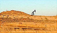
Elk Basin, at the northern end of the Bench, was one of the largest producing oil fields in the world in the late 1940's.
In the late 1970's the Bench was under active consideration for irrigation and homesteading.
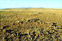
The town of Elk Basin was a thriving place until the late 1940's, when the
houses were moved to Powell. A few trees and a grid of eroding streets are all
that remain to mark the site.